Three of my friends, including Mike Peters, from our CWRT, and I spent the day touring the battlefield at Perryville yesterday. I’d only been there once before, in 1994 or 1995, and Mike likewise had only been there once before. Tim was making his first visit, while Rory, our fourth, has been there multiple times. As you will see from the photographs, it was an absolutely magnificent day–lots of sun, blue skies, no humidity, gentle breezes, and about 80 degree temperatures. One could not have asked for any better weather for battlefield stomping.
The last time that I was there, there was only a fraction of the interpretation that’s present now, and thanks to the efforts of the CWPT, lots of land has been added to the park. It is important to note that the battlefield is a Kentucky state park, NOT a national park. Nevertheless, it’s gorgeous, mostly pristine, and has tons of interpretive markers and trails. There are, in fact, more interpretive markers on this battlefield than there are on a lot of the national parks, and I was really impressed by it.
Imagine a battlefield as rural and pristine as Antietam, about the same size, only without all of the monumentation that marks Antietam, and you have Perryville. The battlefield is narrow and very compact; there are places where opposing batteries were blasting away at each other from within cannister range. The battle was one for ridge line after ridge line; the ground undulates and is marked by one ridge after another.
There’s also a nice little visitor center with a decent selection of Western Theater books and some other trinkets (I added another pin to the collection on my CWPT hat), and a small museum with some well-presented exhibits.
We were fortunate enough to have a couple of West Point alums who are retired Regular Army officers with us for a a couple of hours, meaning we were able to get onto some private property and see some sites associated with the battle that we otherwise would not have seen, including the site where Sheridan disobeyed orders and brought on the battle. That was extremely helpful to helping us to understand how things proceeded once fighting broke out.
We easily walked 8 or 9 miles over some extremely hilly, undulating terrain. It was tiring, but we saw pretty much the entire battlefield. I came away from it with a much better understanding of this battle and how it developed and played out. I am going to re-read Ken Noe’s excellent history of the battle, and then I should really have a solid understanding of it.
This beautiful battlefield, with its gorgeous hills and dales and lovely views, could easily and rapidly become one of my very favorites. You can also easily see the entire battlefield in a single day, which is nice. It’s compact and accessible, and I highly recommend a visit.
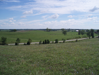
A lovely view from Peters Hill, which was Phil Sheridan’s headquarters during the battle. The view in the distance is of the main battlefield. This is the position from where Sheridan gave the orders that brought on a general engagement in violation of his orders.
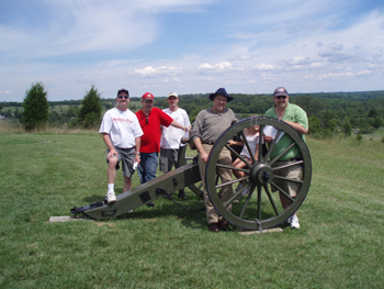
Our group, at Parsons’ Battery. From left to right: Tim Maurice, Mike Peters, Rory McIntyre, Clair Conzelman, Tasha Conzelman, and yours truly.
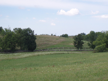
Starkweather’s Hill, from Parsons Battery. This was the highest point on the Union line, a position from which the Union troops were driven.
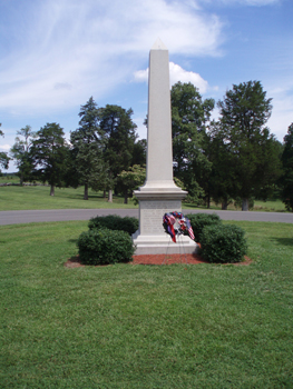
The monument to the Union soldiers on the battlefield near the Confederate cemetery.
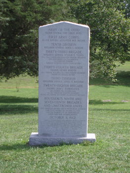
The Union order of battle monument.
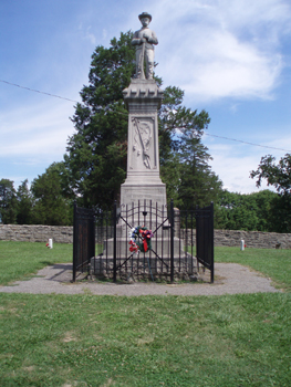
The monument in the Confederate cemetery. This is a mass grave with only two specific soldiers identified with their own headstones. The rest are apparently unidentified.
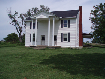
The Dye house, which served as Simon Bolivar Buckner’s headquarters during the battle.
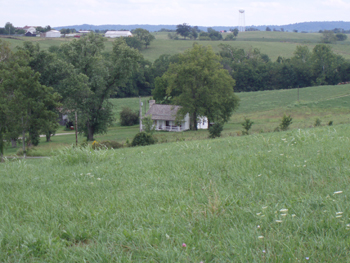
Looking down on the Squire Bottom house from the main Union line.
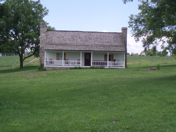
A full shot of the Squire Bottom house. Bottom lost everything as a result of the day when the war visited his property.
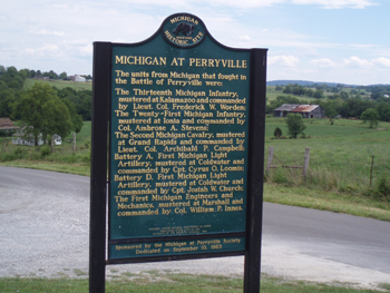
This is a recent addition to the battlefield honoring Michigan’s contributions to the Battle of Perryville. It overlooks the Squire Bottom house.
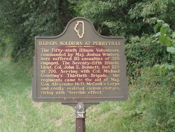
A similar marker honoring Illinois’ contributions to the Battle of Perryville. This is located very near the final Union line, at the Dixville Crossroads.
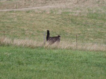
We encountered this cheeky llama at the end of the day, near the position that marked the final Union line of battle near the Davidson house. We determined that he is the sole surviving member of the 143rd Peruvian Llama Cavalry. 🙂
Scridb filterComments
Comments are closed.





 Back to top
 Blogs I like
Far be it from me to take any pleasure from correcting you *ahem* but the “last stand” ridge is near the Wilkerson house, not Davidson.
Your Obedient Servant–
Siege Gun
Eric:
People often ask me why cavalry wasn’t used more effectively at Perryville. Now you know. Llamas.
Ken
Thanks for the correction, Rory.
Glad you came along, mortar boy.
Eric
Ken,
I KNEW there had to be a reason. 🙂
I’m going to start re-reading your book next week. Now that I’ve got a better sense of the ground, I think it’s going to make a great deal more sense to me than it did the first time.
Eric
Eric,
A nice post about a terrific battlefield. I enjoyed my day there in June. By the way – the terrain at Perryville is identical to that at Mill Springs which I went to this past December.
A couple things – the CS cavalry was quite involved to the right of Maney’s Brigade – in fact had they been even more involved they could easily have turned left and smashed Starkweather’s Brigade in their left flank and rolled up the line. Chris pointed this out to me. Ken Haffendorfer’s book “They Died By Twos And Tens” covers the CS cavalry operations during the KY Campaign and there is more than meets the eye.
Secondly, the 1st Tennessee is not the unit that lost their colors there. Based on where I went in June and talking to Chris Kolakowski and some others, it was probably the 27th Tennessee’s flag. The 1st spent most of their time turning Starkweather’s line on the two hills he was posted on – the one with Parson’s Battery and the final hill by the modern goat farm. The 27th came right at the Yankees over both hills. Maney’s and Donelson’s TN Brigades (to Maney’s left) both got hammered and both gave even better than they got.
Lastly, if you went by the Bottom House on the road past the stone fence that went up the hill and ended up in Perryville itself you went right where Adams’ LA Brigade was posted along with the 5th Company Washington Artillery. David Fraley of the Carter House is also an expert on Perryville and he said do not climb on those rocks in the Summer as timber rattlesnakes like to hang out there!!!!
Greg Biggs
Perryville is an excellent field. It has a lot in common with Antietam in that you have a number of large, green federal units there, who really don’t belong on a battlefield; and whom get into a fair amount of trouble once attacked.
I’ve been over the field several times, always enjoyable, and it does have that pristine feel. I was there for a conference in May.
Of course, Wheeler claimed big props at Perryville, speaking of Cav. He would claim that it was his actions that halted Thomas and Crittenden, and that he captured a large number of prisoners. I find his claims to be unsupportable, certainly from the Federal accounts.
Where do you know Clair Conzelman? Claire is a fellow wargamer, small world…
Dave Powell
Dave,
I know Clair from the LBHA. You will be interested to know that he had your hex map from The Gamers’ Perryville game with him on Saturday and used it during his orientation of us. I mentioned your name, and he told me he knew you. It is indeed a very small world.
Not a big surprise about Wheeler. He was notorious for that sort of thing.
Eric
Greg,
We’ve decided that Mill Springs will be our next foray into Kentucky.
Eric
I was also touring Perryville Saturday with my wife. I’m sorry I didn’t see you. I am looking forward to meeting a fellow Phiiy boy now in the Midwest someday. I’m a fan of your work.
That’s Philly Boy.
Glad you got to stop by the jewel of Kentucky as far as battlefields are concerned. The Perryville Battlefield Preservation Association (www.perryville.net) has done a magnificent job of acquiring and preserving this vitally important battlefield.
If you are planning on Mill Springs as your next stop, I can hook you up with a great field guide for your visit. Check out The Mill Springs Battlefield Association (www.millsprings.net), drop them a note, and ask for Bill Niekirk.
I’m sure you dropped some coin in Boyle and/or Mercer County and for that I thank you. 😉 I still consider that God’s Country and my home even though I moved a couple years ago.
Don,
Sorry I missed you.
Eric
Wayne,
We had a great time, and we intend to visit Mill Springs next, although no date has yet been set for that trip. I absolutely agree with you about the Perryville Battlefield Preservation Association’s fine work on the battlefield. Very impressive job indeed.
Eric
For some reason, I vaguely recall someone telling me of a connection between the Squire Bottom house and Patrick Cleburne. Is that true?
Sadly, I do not know my history as well as I should.
Christy,
That’s where Cleburne attacked.
Eric
Hi Eric, Long time reader of your blog but I never post. Sorry to hijack your post but I saw this in the paper this weekend and thought I’d pass it along to you if you haven’t seen it already.
http://www.philly.com/philly/hp/news_update/20080809__quot_Witness_tree_quot__at_Gettysburg_damaged_in_storm.html
Tony,
Thanks for passing that along. I read the Inquirer on line every day, so I saw it on Sunday when it ran.
Eric
Eric,
You will enjoy Mill Springs whose terrain looks a lot like Perryville. They have a nice VC and a good sel-guided tour. The land around it is pretty much pristine too.
Greg
I enjoyed seeing the photographs. Thank you.
I am just starting to research this battle as my great great grandfather took part.
He was 1st Lt. Perry Chance of the 21st Michigan Volunteer Infantry in Sheridan’s Division.
I hope to visit someday.